
#NCARFire an updated evacuation map is now available below and in the public information link on the right side of the page.
The new evacuation map has a RED area that REMAINS CLOSED ALL NIGHT. There are HARD CLOSURES at the intersections of: Cragmoor Road and Lehigh Street, and Bear Mountain Drive and Wildwood Road, and at Highway 93 and Eldorado Springs Drive. The town of Eldorado Springs remains evacuated.
The area that is GREEN on the map represents areas that were evacuated earlier today, but MAY NOW RETURN HOME, and residents are encouraged to remain vigilant for any additional news.
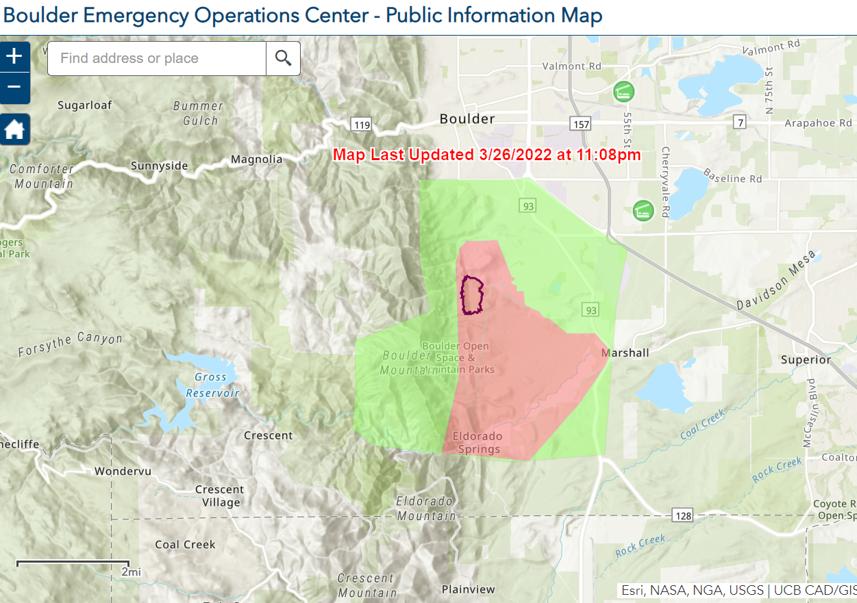
Updated map as of 1110 pm 032622
City of Boulder Open Space and Mountain Parks (OSMP) trails from Chautauqua south to Eldorado Springs Drive remain closed because of the #NCARFire. Please help firefighters by not accessing trails in/near the #NCARFire area tomorrow, Sunday, March 27. Visit OSMPTrails.org to see closed trails.
Comments are closed.